
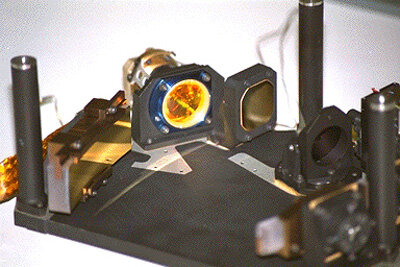
OMEGA, the Observatoire pour la Minéralogie, l’Eau, les Glaces et l’Activité (Bibring et al., 2004), is a visible and near-infrared imaging spectrometer onboard ESA’s Mars Express (MEx) spacecraft, which has been operating in Mars orbit since 12/2003.
Instrument description
OMEGA covers the wavelengths 0.38-5.1 μm with 352 spectral channels, 7 to 20 nm wide. Spatial resolution varies from ~300 m to 5 km per pixel depending on the spacecraft altitude at the time of acquisition. OMEGA’s Signal-to-Noise ratio (or ‘S/N’) is better than 100 over the whole spectral range (and can reach 1000 for some spectels), allowing detection of absorption bands as shallow as ~1%.
The OMEGA instrument actually consists of two co-aligned grating spectrometers:
- Visible and near infrared (VNIR) in the range 038-1,05 μm, building images in a “pushbroom” mode with a two-dimensional detector, with 96 elements in the spectral dimension
- Short wavelength infrared (SWIR) in the range 0.93-5.1 μm, building images in a “whiskbroom” mode with two 128-element line detectors over the wavelength ranges 0.93-2.73 μm (SWIR-C) and 2.55-5.1 μm (SWIR-L)
A moving mirror generates images either 16, 32, 64 or 128 pixels wide depending on the altitude and speed of the spacecraft relative to Mars: the lower the altitude, the faster the spacecraft and the narrower the images in order to yield contiguous pixels with a sufficient integration time on each of them.
MEx orbit is indeed highly elliptical, which yields various observation conditions, with wide coverage at coarse spatial resolution from high altitude or finer spatial resolution but narrow coverage from low altitude, closer to periapsis. The secular precession of MEx orbit since mission start has allowed observation of most of the planet from various altitudes and at various local times. As a consequence, OMEGA observations have various spatial resolutions, various widths and have been obtained under various incidence and emission conditions. This particularity, notably with respect to most other datasets from spacecraft in heliosynchronous low mars orbit, has to be taken into account.
Downloading and processing OMEGA data
From the “Map” tab, zoom-in on your region of interest, and then display one (or more) of the OMEGA layers in the layer controls (OMEGA dataset is divided by width to help sort products). You can see the CRISM product footprints. Use the “Select” button to choose the products you desire over an area. Use the right-click context menu to add your selection to your workspace.
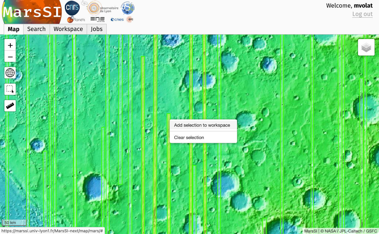
In the "Workspace" tab, you will see your products selection. OMEGA subproduct list consist only in a CATRDR entry. Select entries by ticking the input on the left column (you can use the "Select all" button to select all visible products) and click on the "Copy" action to request a copy of the data in your personal directory. You can then proceed to download products as described in the SFTP section.
Data description
Directory content
The content of an OMEGA product directory in MarsSI should look like:
- ORB2976_4.QUB, ORB2976_4.NAV
- raw data
- ORB2976_4_albedo.jpg, ORB2976_4_color_ir.jpg, ORB2976_4_color_vis.jpg
- quicklooks
- ORB2976_4_corr.bsq, ORB2976_4_corr.bsq.hdr
- calibrated and corrected cube
- ORB2976_4_geo.bsq, ORB2976_4_geo.bsq.hdr
- calibrated, corrected and map-projected cube
- ORB2976_4_param.bsq, ORB2976_4_param.bsq.hdr
- parameters
- ORB2976_4_param_p.bsq, ORB2976_4_param_p.bsq.hdr
- parameters?
Calibrated products
Before OMEGA data can be used for science it must be processed to the so-called ‘Level-2’, which is calibrated radiance (in physical units: W.m-2.sr-1.μm-1) or reflectance (‘I/F’), which is radiance divided by the solar irradiance at Mars at the time of observation. Reflectance SWIR-C data to be used for spectral analysis of the surface can further be processed to remove (most of) the atmospheric CO2 absorptions using the so-called ‘volcano-scan’ correction (eg. Bibring et al., 1989; Mustard et al., 2005).
One final caveat to consider in using OMEGA data is the evolution of the instrument during the course of the nominal and successive extended missions. Several issues incrementally arose during the life of the instrument, mostly in the SWIR-C channel: the sensitivity of some spectels increased or decreased (‘hot’ and ‘cold’ spectels), which was mitigated by modifying their transfer function in the calibration, but some of those spectels eventually failed, resulting in an incremental loss of exploitable channels with time, mostly in the SWIR-C channel. Eventually the whole SWIR-C channel failed in ~2010. These artifacts, along with others, which arose in some observation modes, were mitigated by a continuously evolving pipeline of calibration from Level-1B to Level- 2 data.
For more information on OMEGA instrument and data, check-out the OMEGA Experiment Archive Interface Control Document available from ESA’s Planetary Science Archive (http://www.sciops.esa.int/index.php?project=PSA&page=mex): ftp://psa.esac.esa.int/pub/mirror/MARS-EXPRESS/OMEGA/MEX-M-OMEGA-2-EDR-FLIGHT-V1.0/DOCUMENT/EAICD_OMEGA.PDF
Working with OMEGA parameters
Please consider these products with a critical eye. Despite using labels describing specific mineral (or other) detection, please keep in mind that the spectral parameters mapping does not represent mineralogical maps. They are the result of spectral analysis results that are *USUALLY* typical of such minerals presence, and is presented as an evidence, but not a definitive proof of such.
To infer the true mineralogy of one location, the associated spectra (in corr or corr_medianratio cubes) should be studied carefully. Be cautious to not overinterpret instrument artefacts and other false positive as real results!
The cubes produced by MarsSI contains computed spectral parameters. They account on each pixel for the likeness between the observation spectrum and the theoretical spectrum of a mineral specie, but can also give information on the position of absorption band, intensity of one particuliar band, etc. This cube is used to map spectral features.
The details of how the different parameters can be used are as follows (as in february 2021):
| Band number | Parameter | Detections (non exhaustive) | Details |
| 1 | Quality | TODO | TODO |
| 2 | MOLA | TODO | TODO |
| 3 | Local | TODO | TODO |
| 4 | Olivine | TODO | TODO |
| 5 | LCP | TODO | TODO |
| 6 | HCP | TODO | TODO |
| 7 | Fe-(h)ox | TODO | TODO |
| 8 | FeMg-phy | TODO | TODO |
| >9 | FeMg-vermiculite | TODO | TODO |
| 10 | Al-phy | TODO | TODO |
| 11 | Chlorite | TODO | TODO |
| 12 | Prehnite | TODO | TODO |
| 13 | Carbonate | TODO | TODO |
| 14 | Jarosite | TODO | TODO |
| 15 | Monohyd. | TODO | TODO |
| 16 | Polyhyd. | TODO | TODO |
| 17 | Gypsum | TODO | TODO |
| 18 | Gypsum | TODO | TODO |
| 19 | R0702 | TODO | TODO |
| 20 | R0578 | TODO | TODO |
| 21 | R0505 | TODO | TODO |
| 22 | R2527 | TODO | TODO |
| 23 | R1500 | TODO | TODO |
| 24 | R1328 | TODO | TODO |
| 25 | R1084 | TODO | TODO |
| 26 | BD1500_H2O | TODO | TODO |
| 27 | BD1429_CO2 | TODO | TODO |
| 28 | BD229+BD234_CO2 | TODO | TODO |
| 29 | OLINDEX | TODO | TODO |
| 30 | LCP | TODO | TODO |
| 31 | HCP | TODO | TODO |
| 32 | Ody_Fe3+ | TODO | TODO |
| 33 | Ody_nanophaseFe | TODO | TODO |
| 34 | Ody_Pyroxene | TODO | TODO |
| 35 | Ody_OSP1 | TODO | TODO |
| 36 | Ody_OSP2 | TODO | TODO |
| 37 | Ody_OSP3 | TODO | TODO |
| 38 | Thermal | TODO | TODO |
| 39 | CO2 | TODO | TODO |
| 40 | No airborne dust mask | TODO | TODO |
| 41 | No ice clouds over dust mask | TODO | TODO |
Naming convention
The first hierarchical sorting of the OMEGA data archive is the splitting in various ‘missions’ corresponding to the nominal science phase of MEx (Nom) and to 4 successive mission extensions (Ext1 to Ext4). In each ‘mission’, OMEGA data are sorted by MEx orbit number and observation number in each orbit.
Each observation is archived as 2 binary files with plain-text headers at file beginning:
- ORBNN/ORBNNYY_X.QUB: raw science data at the so-called ‘Level-1B’ (uncompressed, uncalibrated raw digital numbers issued from the detectors)
- GEMNN/ORBNNYY_X.NAV: geometrical observation parameters such as incidence angle, latitude and longitude, etc.
Where
- NNYY is orbit number with NN in hexadecimal format and YY in decimal format, eg. ‘BA32’
- X is observation number of orbit NNYY
A sequence of observations from one orbit typically starts (resp. ends) with a wide image at low spatial resolution taken from high altitude toward (resp. from) narrower images at higher spatial resolution taken closer to periapsis, ie. from low altitude.
References
- Bibring, J.-P., et al. (2004), OMEGA: Observatoire pour la Minéralogie, l'Eau, les Glaces et l'Activité, in Mars Express - The Scientific Payload, European Space Agency Special Publication, SP-1240, edited, pp. 37-49, ESA.
- Bibring, J. P., et al. (1989), Results from the Ism Experiment, Nature, 341(6243), 591-593.
- Mustard, J. F., et al. (2005), Olivine and pyroxene, diversity in the crust of Mars, Science, 307(5715), 1594-1597.