
![[VIMS picture]](/wiki/+get/+ff03e2312418476a8fe506ac480d6fc4/VIMS/VIMS-IR.jpg)
The Visual and Infrared Mapping Spectrometer (VIMS) is an instrument onboard the Cassini mission.
Instrument description
VIMS included a pair of distinct imaging grating spectrometers that were designed to measure reflected and emitted radiation from atmospheres, rings and surfaces to determine their compositions, temperatures and structures.
VIMS-V (visible and near infrared line scan spectrometer) from 0.35 to 1.07 µm (96 bands)
VIMS-IR (infrared 2D scan spectrometer) from 0.85 to 5.1 µm (256 bands)
FOV: 32x32 mrad for both spectrometers
Mass: 37 kg
Important note: only the VIMS-IR data are present in PSUP portal.
Downloading and processing VIMS data
Imagery
Tutorial
From the “Maps” tab, zoom-in on your region of interest. You can swith backgrounds for more visibility, and then display the VIMS layer. You can see the VIMS products footprints that appear in pink. Use the “Select” button to choose the products you desire over an area. Use the right-click context menu to add your selection to your workspace.
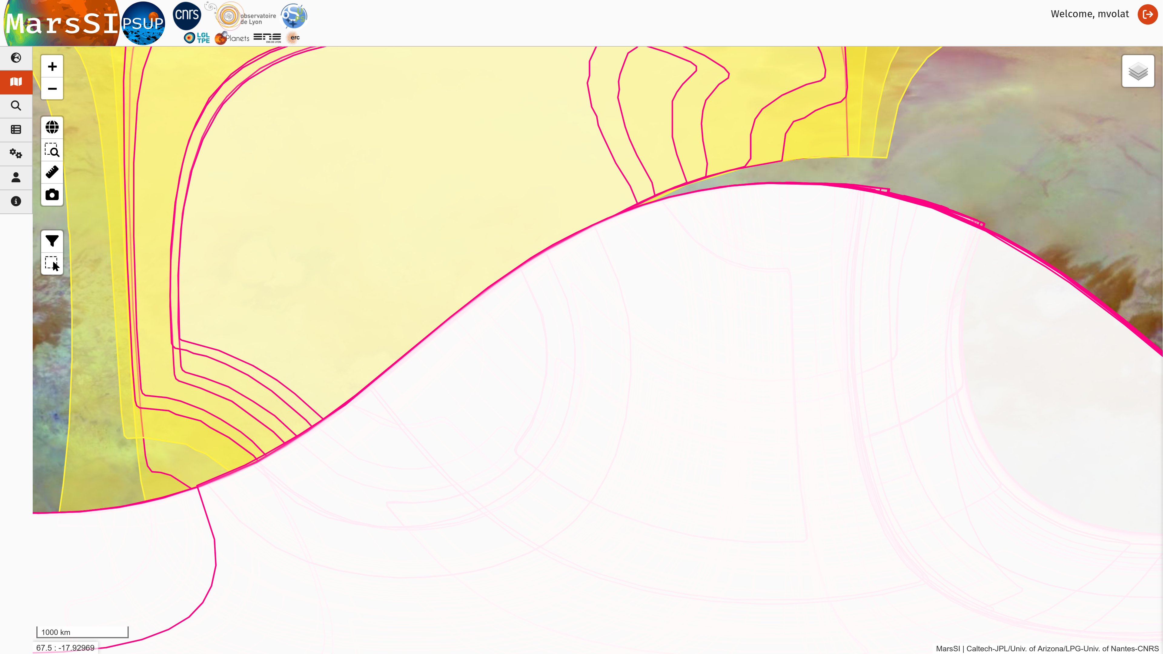
But given how dense and global is VIMS coverage, you might want to use the text search tab using keyworks "titan", "vims" and a coordinate.
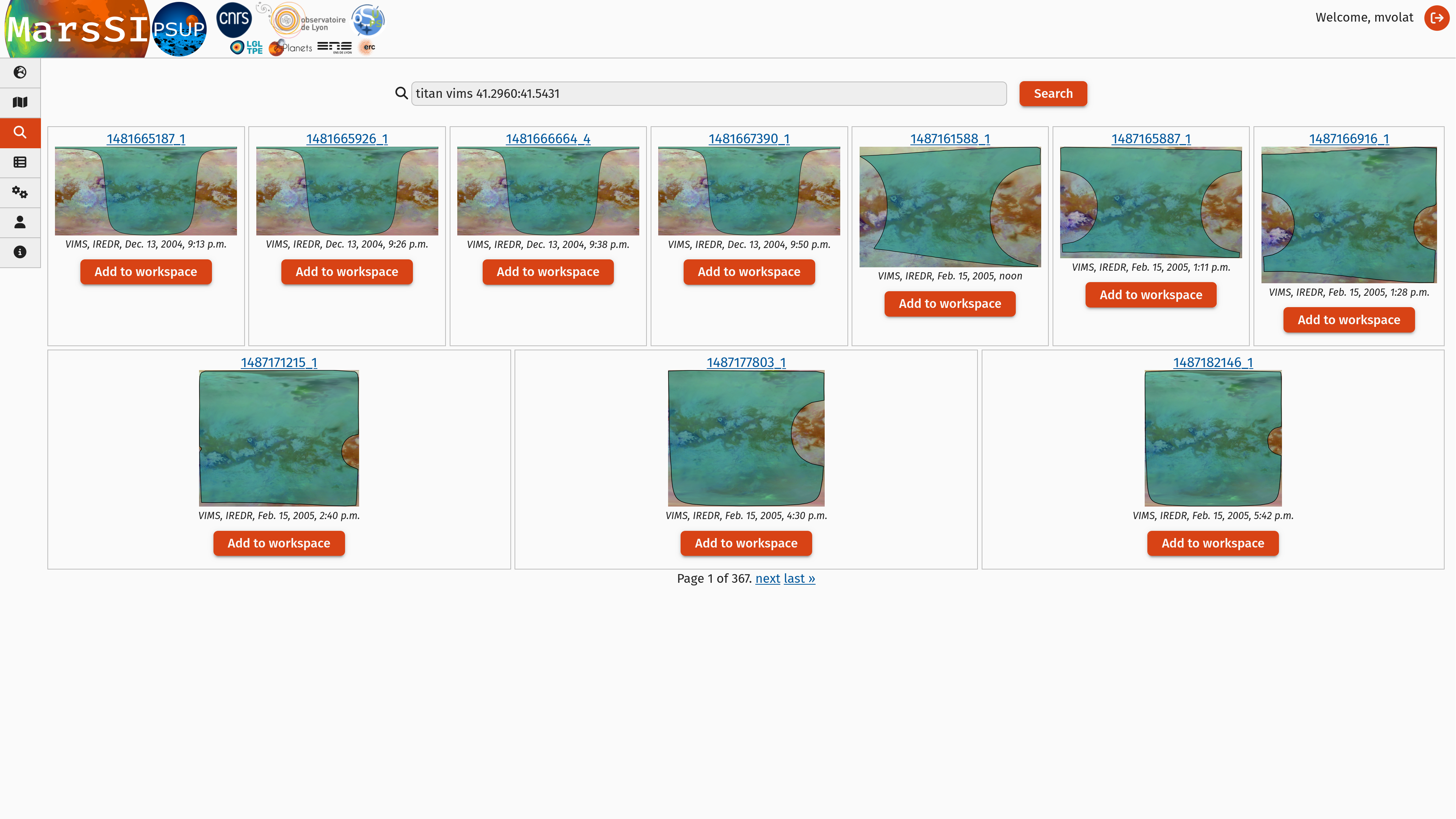
In the "Workspace" tab, you will see your product selection. VIMS images are already processed by its science team, MarsSI directly provide the map-projected products (MRDR).
Check the product status: if some data is not already done yet, select the rows you would like to request by ticking the input on the left column (you can use the "Select all" button to select all visible products) and click on the "Process" action on the top of the workspace table. You can check more information about the processing in the job tab if needed.
Once all the data you would like is done, select entries by ticking the input on the left column (you can use the "Select all" button to select all visible products) and click on the "Copy" action to request a copy of the data in your personal directory. You can then proceed to download products as described in the SFTP section.
License
This dataset is distributed under a CC-BY-4.0 license with the following attribution: NASA/Caltech-JPL/University of Arizona/Osuna-CNRS-Nantes Université.
Pipeline information
The data was processed by the VIMS science team using an ISIS-based procedure (click for more details).
Data description
Images
Directory content
The content of an VIMS product directory in MarsSI should look like:
- 1686495872_1-G_101.jpg
TODO
- 1686495872_1-G_203.jpg
TODO
- 1686495872_1-G_212.jpg
TODO
- 1686495872_1-G_501.jpg
TODO
- 1686495872_1.log
TODO
- 1686495872_1-R_159_126.jpg
TODO
- 1686495872_1-R_203_210.jpg
TODO
- 1686495872_1-RGB_203_158_279.jpg
TODO
- 1686495872_1-RGB_231_269_195.jpg
TODO
- 1686495872_1-RGB_277_327_332.jpg
TODO
- 1686495872_1-RGB_501_158_129.jpg
TODO
- 1686495872_1-RGB_501_275_203.jpg
TODO
- 1686495872_1-RGB_501_332_322.jpg
TODO
- C1686495872_1_ir.cub
TODO
- v1686495872_1.lbl
TODO
- v1686495872_1.qub
TODO
Georeferencing
Georeferencing was done through orbital information.
References
VIMS instrument description at NASA
VIMS observation portal at LPG/OSUNA: vims.univ-nantes.fr
Le Moulélic et al. (2019), The Cassini VIMS archive of Titan: From browse products to global infrared color maps - doi:10.1016/j.icarus.2018.09.017
Brown et al. (2004): The Cassini VIMS archive of Titan: From browse products to global infrared color maps - doi:10.1007/s11214-004-1453-x