
Diff for 'HRSC'
|
Editor:
Volat, Matthieu
Size:
1407:
Time:
2020-04-29 11:52:38z
Comment:
|
Editor:
mvolat
Size:
1722:
Time:
2024-08-27 09:03:59z
Comment:
|
| Deletions are marked like this. | Additions are marked like this. |
| Line 1: | Line 1: |
| {{{#!wiki warning '''Page under construction''' |
|
| Line 2: | Line 4: |
| {{{#!wiki warning | |
| Line 6: | Line 7: |
| {{attachment:The_High_Resolution_Stereo_Camera_HRSC_pillars.jpg||align="right"}} | {{/The_High_Resolution_Stereo_Camera_HRSC_pillars.jpg}} |
| Line 9: | Line 10: |
| Line 17: | Line 16: |
| * RDRv3 : Radiometric Data Record, version 3, 1-channel JPEG2000 images with a LBL file * REFDRv3 : map-projected RDR products, 1-channel JPEG2000 images with LBL file |
* RDRv3 : Radiometric Data Record, version 3, 1-channel * REFDRv3 : map-projected RDR products, 1-channel |
| Line 21: | Line 20: |
| When loading JPEG2000 files in a GIS software, you should use the LBL as entry point to have proper georeferencing. | These images are usually in the PDS data format, the suffix indicates the data content of the image: * ND = nadir * BL = blue * GR = green * IR = near IR * RE = red * DT = DEM sphere * DA = DEM aeroid There can also be S1, S2, P1, P2 and ND types that represent panchromatic channels [TODO: find if the wavelengths are constant across images] |
| Line 31: | Line 40: |
| ... | .. == References == * Product suffix description: [[https://ode.rsl.wustl.edu/Mars/pagehelp/quickstartguide/hrsc_refdr3.htm]] |
Page under construction
This page is not finished yet
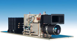
The HRSC on board ESA's Mars Express will image the entire planet in full colour, 3D and with a resolution of about 10 metres. Selected areas will be imaged at 2-metre resolution.
Data description
MarsSI propose the following products from the HRSC dataset:
- RDRv3 : Radiometric Data Record, version 3, 1-channel
- REFDRv3 : map-projected RDR products, 1-channel
- DEM : Digital Elevation Model
These images are usually in the PDS data format, the suffix indicates the data content of the image:
- ND = nadir
- BL = blue
- GR = green
- IR = near IR
- RE = red
- DT = DEM sphere
- DA = DEM aeroid
There can also be S1, S2, P1, P2 and ND types that represent panchromatic channels [TODO: find if the wavelengths are constant across images]
Downloading HRSC data
HRSC Imagery
From the “Maps” tab, zoom-in on your region of interest, you can display the THEMIS mosaic for more precision, and then display the "MEX - HRSC RDRv3" layer. You get all HRSC RDRv3 footprints that appear in purple. The footprint are regularly updated to take into account new data. You can use the “Select” button to choose the footprints you desire. You can choose several footprints by clicking several stamps, or by dragging your mouse to select adjacent footprints. You can also use the “Search” button for more options.
Digital Elevation Models
.
References
- Product suffix description: https://ode.rsl.wustl.edu/Mars/pagehelp/quickstartguide/hrsc_refdr3.htm