Diff for 'CASSIS'
|
Editor:
mvolat
Size:
2878:
Time:
2024-09-23 06:29:46z
Comment:
Create CaSSIS page
|
Editor:
mvolat
Size:
2944:
Time:
2024-09-23 08:23:58z
Comment:
Fix directory content listing, and mention we convert data to geotiff.
|
| Deletions are marked like this. | Additions are marked like this. |
| Line 3: | Line 3: |
| The Context Camera (CTX) is a camera on board the Mars Reconnaissance Orbiter (MRO). | Colour and Stereo Surface Imaging System (CaSSIS) is a camera on board ESA's Trace Gas Orbiter (TGO). |
| Line 20: | Line 20: |
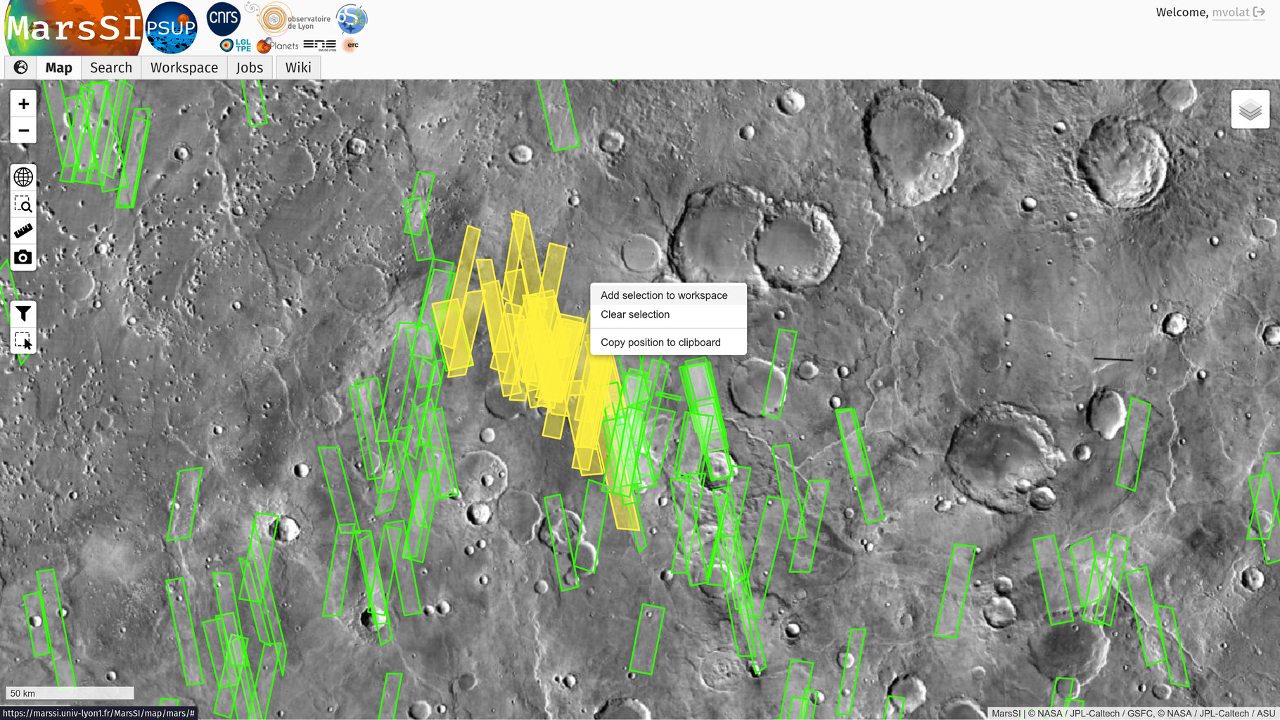
| {{/select_ctx.jpg||width="800"}} | {{/select_cassis.jpg||width="800"}} |
| Line 30: | Line 30: |
| This data was processed by the CaSSIS science team ([[https://www.cassis.unibe.ch/]]). Initial observation frames are already stitched in a single image. | This data was processed by the CaSSIS science team ([[https://www.cassis.unibe.ch/]]). Initial observation frames are already stitched in a single image. The CaSSIS team provides data in the ISIS format, MarsSI converts it to GeoTIFF. |
| Line 41: | Line 41: |
P16_007430_1783_XN_01S083W.IMG |
Colour and Stereo Surface Imaging System (CaSSIS) is a camera on board ESA's Trace Gas Orbiter (TGO).
Instrument description
The primary mirror is around 13.5 cm in diameter. The mirrors are held in a carbon fiber reinforced polymer (CFRP) structure. The focal plane will comprise a single silicon hybrid detector with 4 colour filters mounted on it following the push-frame technique to be used by the SIMBIOSYS experiment onboard ESA’s BepiColombo.
The expected resolution is 4m/px, the available colors in each image is dependent of the acquisition (later observation should provide full spectrum). The camera was designed for stereo acquisitions, but early issues prevented this uses.
Downloading and processing CaSSIS data
Imagery
Tutorial
From the “Maps” tab, zoom-in on your region of interest. You can swith to the THEMIS or CTX mosaic for more precision, and then display the CaSSIS layer. You can see the CaSSIS products footprints that appear in pink. Use the “Select” button to choose the products you desire over an area. Use the right-click context menu to add your selection to your workspace.

In the "Workspace" tab, you will see your product selection. CaSSIS images are already processed by its science team, MarsSI directly provide the map-projected products (MRDR).
Check the product status: if some data is not already done yet, select the rows you would like to request by ticking the input on the left column (you can use the "Select all" button to select all visible products) and click on the "Process" action on the top of the workspace table. You can check more information about the processing in the job tab if needed.
Once all the data you would like is done, select entries by ticking the input on the left column (you can use the "Select all" button to select all visible products) and click on the "Copy" action to request a copy of the data in your personal directory. You can then proceed to download products as described in the SFTP section.
Pipeline information
This data was processed by the CaSSIS science team (https://www.cassis.unibe.ch/). Initial observation frames are already stitched in a single image. The CaSSIS team provides data in the ISIS format, MarsSI converts it to GeoTIFF.
Data description
Images
Directory content
The content of an CaSSIS product directory in MarsSI should look like:
- projected and georeferenced image from the RDR
Georeferencing
Georeferencing was done through orbital information.
References
- CaSSIS instrument description website: https://www.cassis.unibe.ch/
