
Diff for 'About'
|
Editor:
Volat, Matthieu
Size:
1034:
Time:
2022-03-28 09:31:54z
Comment:
|
Revision:
10
Editor:
Volat, Matthieu
Size:
1018:
Time:
2022-03-28 09:31:55z
Comment:
Converted moin 1.9 markup to moinwiki markup
|
| Deletions are marked like this. | Additions are marked like this. |
| Line 5: | Line 5: |
| {{attachment:overview2.png||height=300px}} | {{/overview2.png||height="300px"}} |
| Line 7: | Line 7: |
| MarsSI is a part of [[https://psup.cnrs.fr/en/|PSUP (Pôle des SUrfaces Planétaires)]], and provides the data for the visualization interface MarsVisu. | MarsSI is a part of [[https://psup.cnrs.fr/en/|PSUP (Pôle des SUrfaces Planétaires)]], and provides the data for the visualization interface [[MarsVisu]]. |
| Line 12: | Line 12: |
| Line 13: | Line 14: |
| * Cathy Quantin-Nataf (Pr, Univ. Lyon): PSUP project lead, MarsSI project lead | * Cathy Quantin-Nataf (Pr, Univ. Lyon): PSUP project lead, MarsSI project lead |
| Line 15: | Line 16: |
| * Matthieu Volat (Engr, CNRS): MarsSI technical lead | * Matthieu Volat (Engr, CNRS): MarsSI technical lead |
Overview
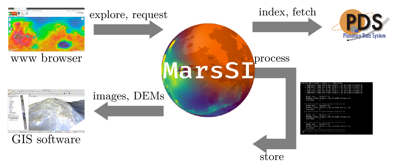
MarsSI (Acronym of MARS Système d’Information) is a service including a web Geographic Information System application which allows searching, processing and retrieving Martian orbital data. From this application, the users will be able to easily and rapidly select observations, process raw data via automatic pipelines and get back final products which can be visualized under Geographic Information Systems like ARCGIS and QGIS. Moreover MarsSI also proposes an automatic stereo-restitution pipeline in order to produce Digital Terrain Models (DTM).
MarsSI is a part of PSUP (Pôle des SUrfaces Planétaires), and provides the data for the visualization interface MarsVisu.
Organization
People involved in MarsSI:
- Science:
- Cathy Quantin-Nataf (Pr, Univ. Lyon): PSUP project lead, MarsSI project lead
- Technical:
- Matthieu Volat (Engr, CNRS): MarsSI technical lead